Common Roots, Fertile Stories
An Ecopoetics of Agrarian Territories
In response to the limitations of conventional planning tools, our research methodology brings together field investigation, sensitive cartography, and territorial storytelling to reframe the relationship between urbanism and agroecology. Grounded in our dual training, architecture and history, it allows us to anchor fieldwork in both material and immaterial layers of the landscape. Photographs taken in situ and archival documents testify to landscape evolutions and reveal often invisible dynamics. This first phase aims to explore and analyze the territory, in its agricultural, built, and social dimensions.
From this material, we develop sensitive cartographies, subjective mappings that express atmospheres, uses, and tensions. These tools communicate qualitative analysis in a way that is open and accessible to local actors. Finally, the narrative becomes a planning tool: by proposing hypotheses
for transformation, it opens new situated imaginaries, grounded in real practices and the framework of agroecology and commons-based thinking.
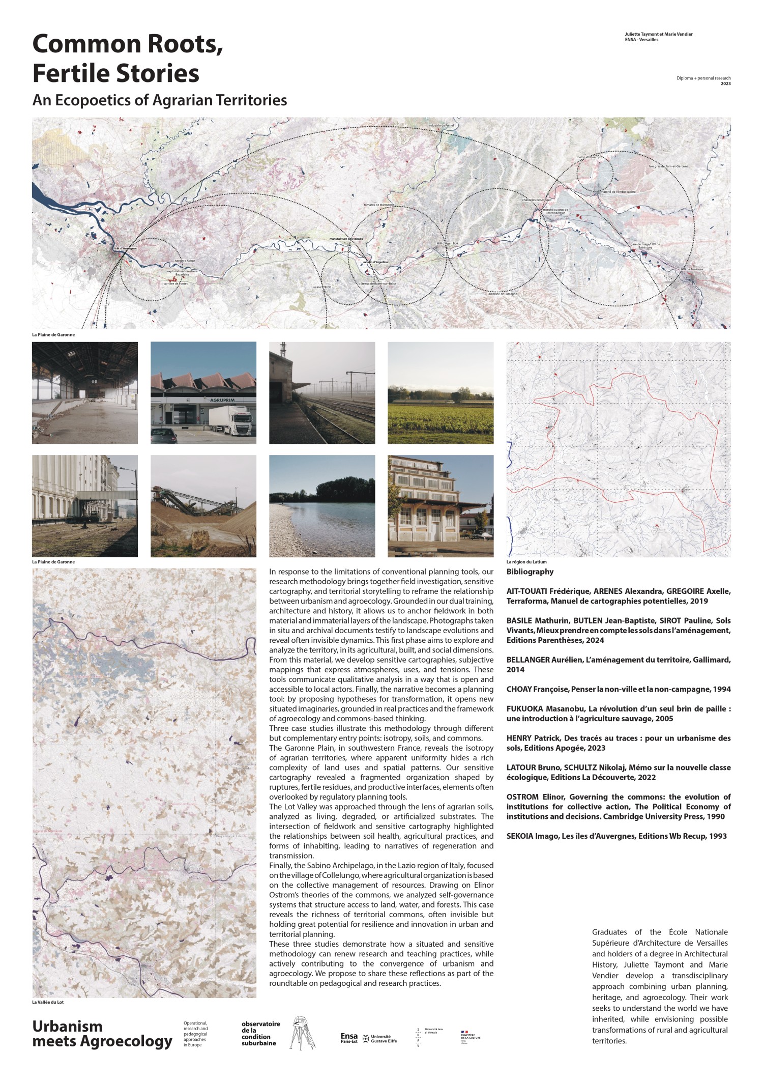
Three case studies illustrate this methodology through different but complementary entry points: isotropy, soils, and commons.
The Garonne Plain, in southwestern France, reveals the isotropy of agrarian territories, where apparent uniformity hides a rich complexity of land uses and spatial patterns. Our sensitive cartography revealed a fragmented organization shaped by ruptures, fertile residues, and productive interfaces,
elements often overlooked by regulatory planning tools.
The Lot Valley was approached through the lens of agrarian soils, analyzed as living, degraded, or artificialized substrates. The intersection of fieldwork and sensitive cartography highlighted the relationships between soil health, agricultural practices, and forms of inhabiting, leading to narratives of regeneration and transmission.
Finally, the Sabino Archipelago, in the Lazio region of Italy, focused on the village of Collelungo, where agricultural organization is based on the collective management of resources. Drawing on Elinor Ostrom’s theories of the commons, we analyzed self-governance systems that structure access
to land, water, and forests. This case reveals the richness of territorial commons, often invisible but holding great potential for resilience and innovation in urban and territorial planning.
These three studies demonstrate how a situated and sensitive methodology can renew research and teaching practices, while actively contributing to the convergence of urbanism and agroecology. We propose to share these reflections as part of the roundtable on pedagogical and research practices.
Juliette Taymont specializes in heritage studies at the ACMH Pierre-Antoine Gatier, providing an in-depth perspective on the
conservation and enhancement of built heritage.
Marie Vendier, meanwhile, draws on her knowledge of the history and evolution of
territories at the AREP agency, where she analyzes territorial dynamics and their contemporary challenges.
Their shared experience, notably their time at the architecture and urban planning agency AUC, enriched by fieldwork in France and Italy, as well as their combined training in architecture and history, enables them to
approach the territory in all its complexity, from the macro to the micro, transcending administrative and disciplinary boundaries. This approach opens up a new interpretation of territorial continuities, attentive to the land,
sensitive narratives, and the commons.
← go back to
the programme
Affiche scientifique →
voir l'affiche en grand